Today's post is of another wonderful nearby destination from the marina. This time it was a short drive to Reid State Park.
Before I begin with today's pictures and description, I will answer the question that many of you may be asking - why have we seemingly not been on the move from the marina? Well, the reasons are several.
The main reason is that for us now "fair weather sailors" the evenings are still chilly and being at the dock with the built in electric heaters on thermostats is just too cozy to pass up. Also, there are still chores to be done. This morning was continuing to wax the topsides of the boat, a job I really dislike because it is very difficult to work alongside the cabin on the boat with the narrow walkway and the lifelines that get in the way - oh, well a good reason to spread out the chore over several days. Also, we have found a very nice place in Brunswick to play pickleball. So being at the dock this time of year is more like being in a summer cottage. And we are finding wonderful things to do right in our own "backyard." So with that as a great lead in - on to Reid State Park.
From the map below, you can see it is only about 5 miles from the marina. It is located on the SE end of the Georgetown peninsula. There are very few beaches north of Portland and this area that extends west to Popham Beach is a wonderful oddity along the rugged Maine coast.
The wonderful thing about this time of year is that there is no entrance fee - saved 18 dollars!!!
The other thing about today was that the wind was in an offshore direction. This meant that the breeze, though strong, was short sleeve warm. It was one of the reasons for taking our walk today. Had the same wind been coming in from the ocean it would have been a very different temperature and certainly we would have had far more clothes to break the bite of the wind.
This is the east end of the park, looking east to the south end of Southport Island. If you look closely you can see the Cuckolds Lighthouse just to the right of center. One would round it and then head north to reach Boothbay Harbor. While still important today, back when travel by sea for passengers was a major happening, this and other lighthouses were key to a safe journey - think no Google Maps with navigation that will tell you to the minute when you will arrive - and where you are along the route. PS I first traveled in our boats using only the long used compass, charts and a watch - and the lighthouses were really my friend.
Looking westerly from the same point
We drove around to the beach parking lot and headed to the beach.
This is a saltwater pond behind the sand dunes of the beach,
Looking west
At the west end of the beach here - that is Sequin Island in the distance over the point. Sorry if I sound redundant, but the walk was so full of beautiful sights that it was nearly overwhelming.
Looking back to the east along the beach.
Heading to walk back along the beach
Look at the pile of trees and the like. Can you say "driftwood?"
The tide is receding and the sand at the water's edge is hard packed and saturated with water.
This produces really neat water sculpture from the water leaving the sand for the retreating wave line
On the way down I noticed this beautiful freshwater pond along the main road. I stopped as I had noticed there was a really large beaver hutch that begged to have its picture taken - which I did and took some of the beautiful pond.
The unexpected find was that a trail seems to head off in a circle around the pond - added to the list to check out - more places we didn't know existed so close by!!!!
And this is on the turn off to Reid State Park. It has been freshly painted and is amazingly detailed - It would be even more impressive if the shot was more straight on to the rock face.
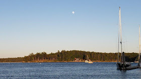
And you can see from the picture from back at Robinhood, that the tide is indeed low - never get tired of the scene changes caused by the tides. That is one of the marvelous things that makes the Maine Coast an amazing place to see and boat.
From the deck of Perelandra, a shot of the beautiful sunset.
So you can see it is time to say ......
Good Night and May God Bless


