Yesterday (Wednesday) we motored to one of our favorite spots - Seal Cove on the Damariscottia River. As you can see from the chart screen shots below, it is located just east of Boothbay Harbor. Seal Cove is under the center of the cross hairs and Robinhood Marina is where the red arrow is shown.

Both days were glorious. Really feels like summer is gaining the upper hand. The photo below shows the beautiful blue sky that was so welcomed.
The other thing to note in this shot is the bald eagle sitting the nest in the tree just to the left of center. There is a large eaglet in the nest - can't see here but we did see it later.
This is located on the northerly end of Hodgsons Island. It formed the west side of our anchorage.

I have said in other posts that we never stop finding great surprises along the coast. Here is one such new find. The landing area shown below is just a short way from the eagle's nest shown above. And we are on Hodgsons Island. This island forms the westerly edge of our anchorage. We have been coming to the spot for over 40 years. Just this year I discovered that the island is open to the public and has trails all around the perimeter. There is no sign visible from the water it is little used so I have never seen anyone land here. Well a great find it was!! The photos are from our first hike on Wednesday afternoon.

And here is the sign for the preserve located in the woods just away from the "beach."

Looks like the Scarecrow from the Wizard of OZ set the direction of the trails.


It is so cool to look at your boat though the picture frame of a wooded trail.

You can also see Perelandra in this photo.

One thing that makes it difficult to get all the photos you want is a dead cell phone battery. So here are photos from back on the boat in the afternoon.


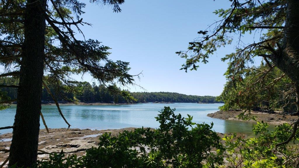
This morning we decided that another hike around the island was in order. The sky was again amazing. One eagle can be seen on the branch near the center of the photo.

And looking from our landing spot to Perelandra.

With a charged battery I was now able to get pictures of the rest of the island.


This is looking from the west side of the island across the Damriscottia River to the mainland

The tide was a "drainer" today and was 1.4 feet below normal.


There was some beautiful moss on the trail that had a fairyland feel to it.

I show this photo to demonstrate that you should be sure of the information that you look up. I thought tide was low at 10:15 - but that was for yesterday - today is was at 11:07. So I again beached the dinghy. But instead of reverting to clever solutions to roll the dinghy seaward as noted in a recent post, we decided to do the easy thing. Walk the trail again while the tide was catching up to my miscalculation.

Well it was a great way to again make lemonade from lemons. So it is again time to say ..........
Good Night and May God Bless
Your photos and narrative make us envious. We had our time there and will likely not be cruising up there again. Thanks for sharing!
ReplyDeleteGo well,
Duane and Diane
m/v Diva Di
Glad you enjoy the posts. We do consider ourselves fortunate to be able to boat here. The powerboat helps us extend our season beyond just the deep summer months.
ReplyDeleteIt is a long way from Florida to Maine so I can understand the effort is great to get here. But I know you had some great time while in Maine and I am glad if I can bring back some pleasant memories.
Safe travels on your future adventures.
Ron and Faye